November 13, 2025
Hurricane Melissa: One of the Strongest Atlantic Hurricanes on Record
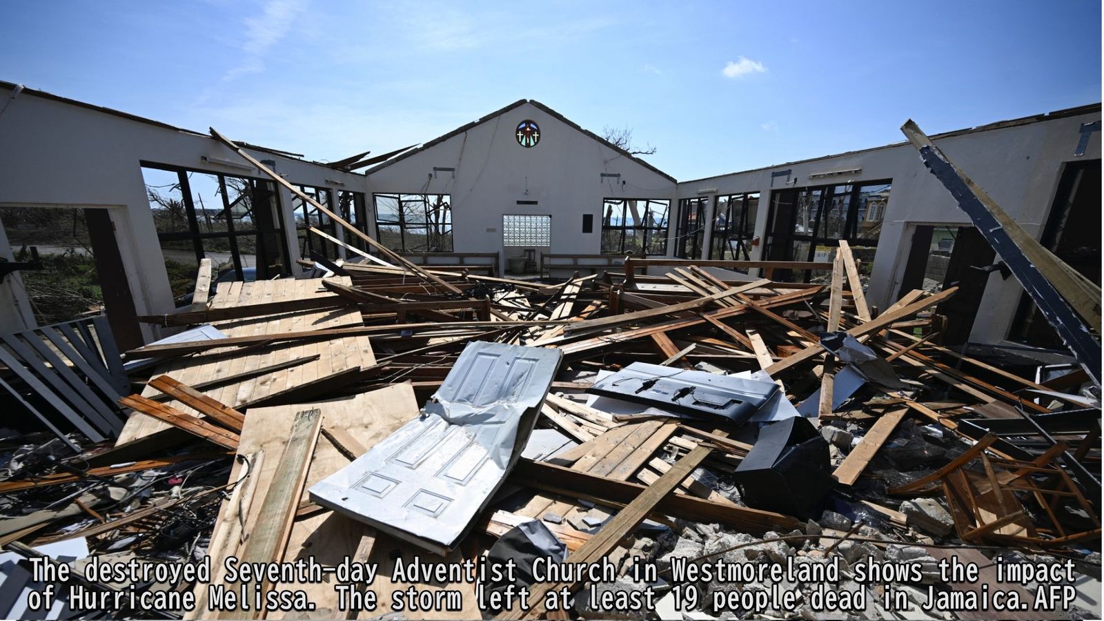
Hurricane Melissa made landfall on Jamaica's western coast on October 28, 2025, as a Category 5 storm, causing catastrophic damage across the region.
Melissa formed over the Caribbean Sea on October 21 and initially moved westward before strengthening and curving northeastward. Near Jamaica, the storm shifted northward, reaching its peak intensity at 15:00 UTC on October 28, with a central pressure of 892 hPa and maximum sustained winds of 80 m/s (160 kt). This places Melissa among the most powerful Atlantic hurricanes on record, comparable to Hurricane Gilbert (1988) and Hurricane Dorian (2019)12.
The hurricane brought widespread destruction as it approached and passed over the region. At least 30 people in Haiti and 19 in Jamaica lost their lives. Coastal areas suffered devastating damage, including collapsed homes and widespread power outages that disrupted electricity and water supplies—impacts that continue to affect many residents3.
Review of Track Forecast Accuracy
To assess the accuracy of track forecasts for Hurricane Melissa, we compared predictions from eight global meteorological models.
Figure 1 shows the forecast tracks issued on October 21, 2025 (12:00 UTC), the day the storm formed. While model predictions varied widely, the ECMWF (European Centre for Medium-Range Weather Forecasts) and DWD (Deutscher Wetterdienst) models correctly predicted landfall over Jamaica.
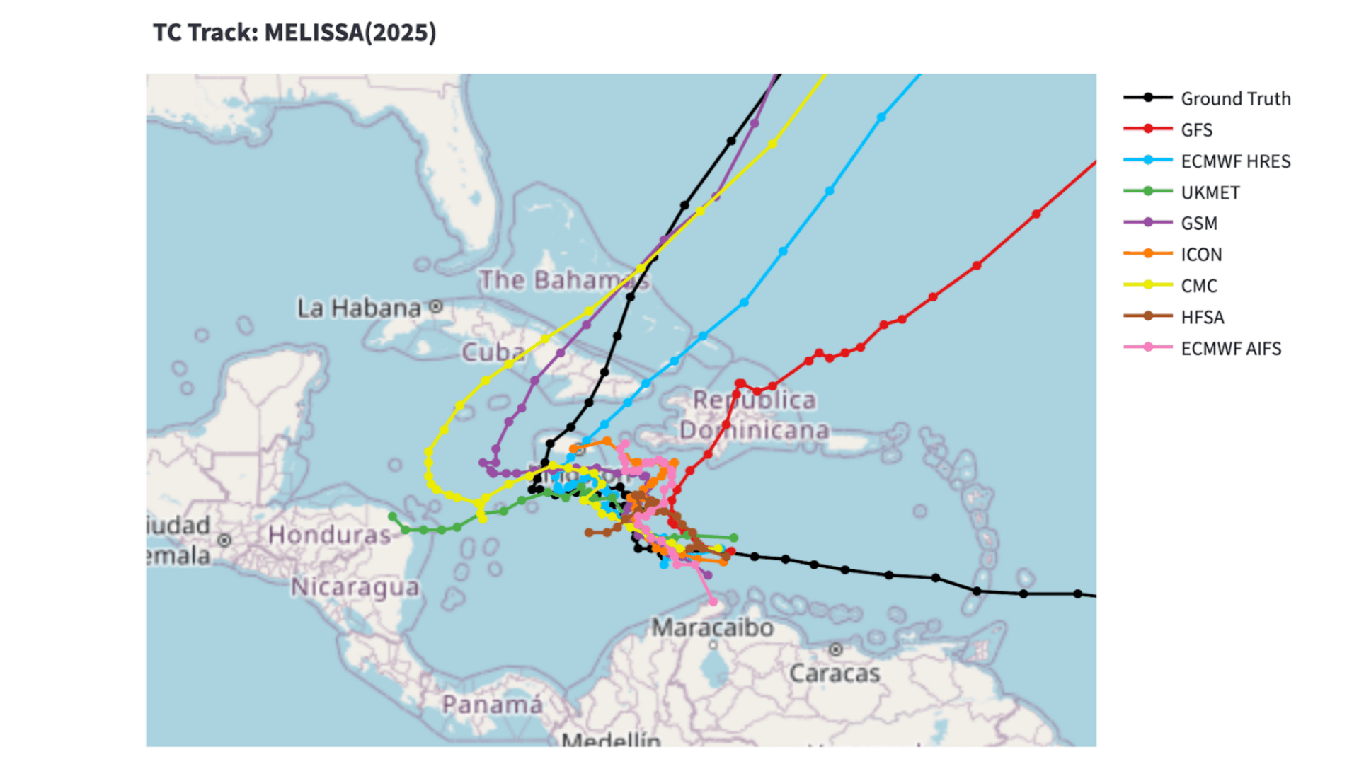
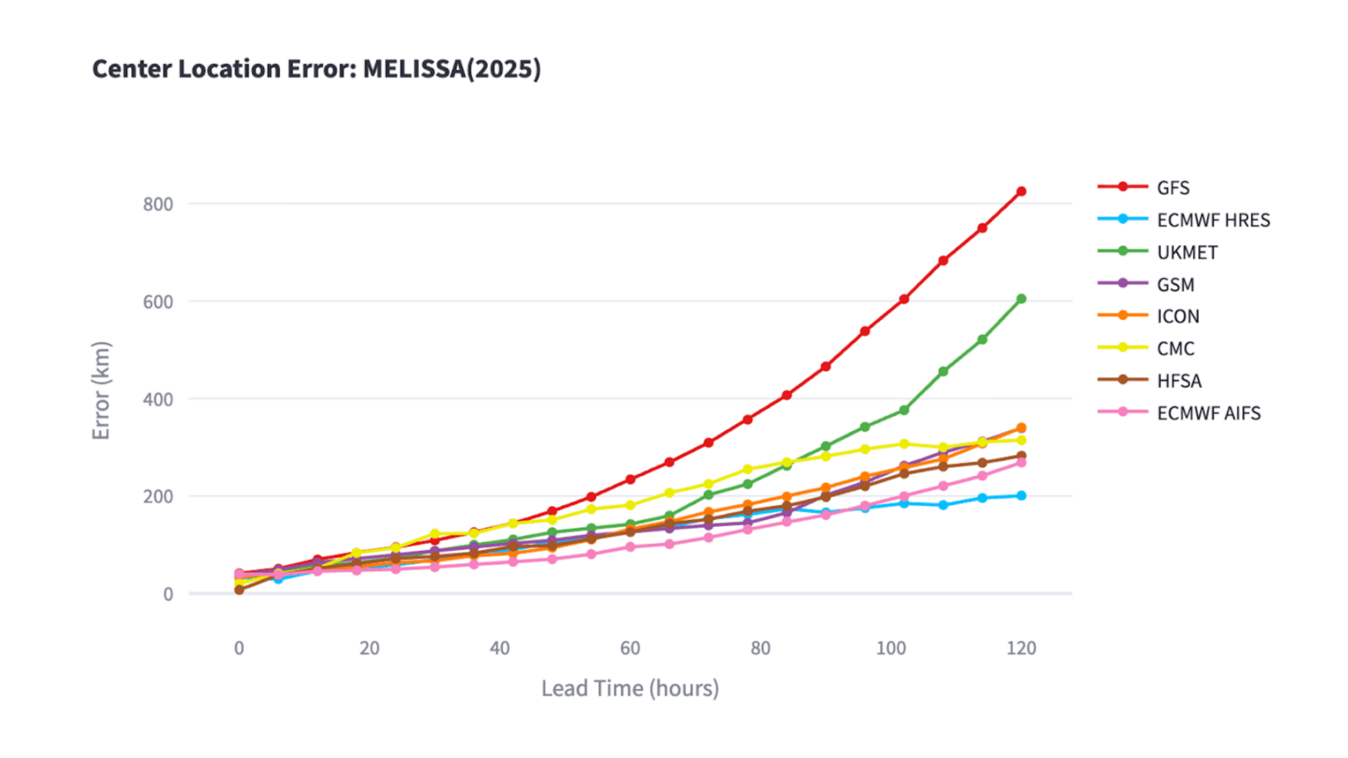
Figure 2 illustrates the relationship between forecast lead time (horizontal axis) and positional error of the hurricane's center (vertical axis).
The ECMWF HIRES (deterministic physical model) maintained positional errors within 200 km for forecasts up to 120 hours ahead, while the ECMWF AIFS (AI-based forecasting system) achieved errors below 90 km for forecasts up to 54 hours ahead.
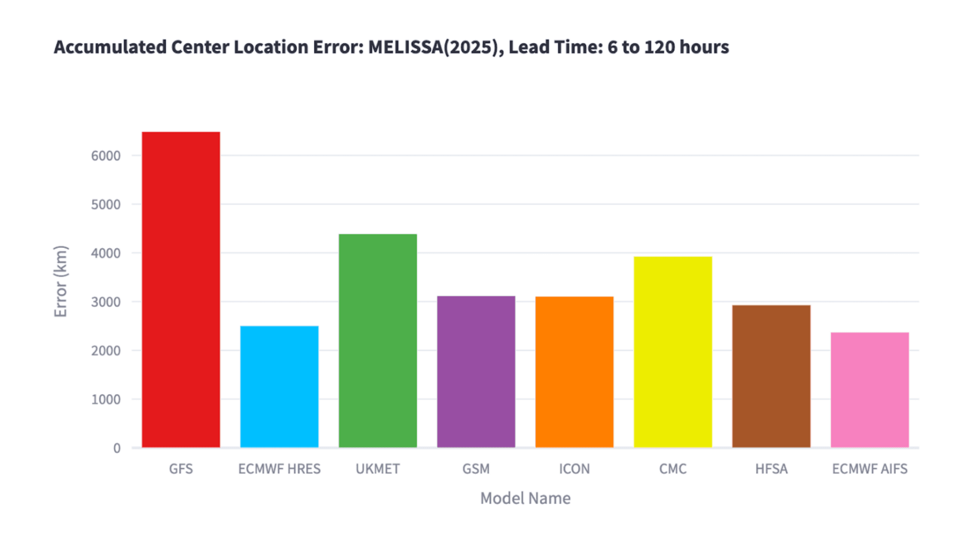
When cumulative forecast errors over 120 hours (Figure 3) were compared, ECMWF's physical model achieved the highest overall accuracy.
GFS (NCEP): National Centers for Environmental Prediction (USA) ECMWF: European Centre for Medium-Range Weather Forecasts UKMET: UK Met Office GSM (JMA): Japan Meteorological Agency CMC: Canadian Meteorological Centre HFSA (NOAA): National Oceanic and Atmospheric Administration (USA) ICON (DWD): German Weather Service
Review of Maximum Wind Speed Forecast Accuracy
We also compared model performance for maximum wind speed forecasts.
Figure 4 shows the relationship between forecast lead time (horizontal axis) and the error in predicted maximum wind speed (vertical axis).
The HFSA (NOAA) model consistently maintained forecast errors below 30 kt for forecasts up to 120 hours in advance, demonstrating the highest wind speed forecast accuracy among all models.


Model abbreviations: GFS (NCEP): U.S. National Centers for Environmental Prediction ECMWF: European Centre for Medium-Range Weather Forecasts UKMET: UK Met Office GSM (JMA): Japan Meteorological Agency CMC: Canadian Meteorological Centre HFSA (NOAA): U.S. National Oceanic and Atmospheric Administration ICON (DWD): Deutscher Wetterdienst (Germany)
Through continuous performance evaluations—including assessments of AI-based forecasting systems—we work to deepen our understanding of each model's characteristics and enhance our forecast accuracy.
Our goal remains the same: to provide highly reliable, precise weather information that supports safety and preparedness for people around the world.
Footnotes
Share

March 27, 2026
Ogasawara Islands to Achieve Japan's Highest Weather Observation Density Through Digital Innovation

March 16, 2026
Japan's Most Comprehensive Cherry Blossom Forecast: How Our Proprietary Bloom Prediction Model Leverages User-Generated Photos and High-Precision Data Across 1,400 Locations

March 13, 2026
How TV Stations Are Transforming Weather Coverage A New Content Solution Helping Broadcasters Navigate Weather and Disaster Reporting