December 11, 2025
Unprecedented: Cyclone Develops in Malacca Strait as Indonesia and Thailand Face Record Rainfall
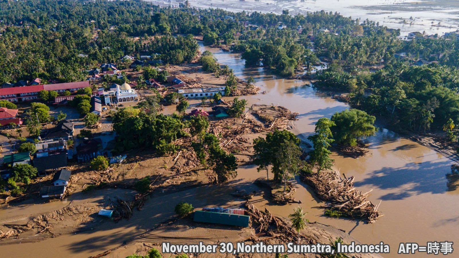
In November 2025, record-breaking heavy rainfall occurred across Southeast Asia. The torrential rains triggered widespread flooding and landslides, resulting in devastating damage and significant loss of life. Indonesia reported 908 fatalities and Thailand 276, with many victims across the region1.
According to SYNOP observational data, parts of Sumatra, Indonesia, recorded over 600 mm of rainfall in the 48 hours leading up to the 26th—approximately three times the region's average November precipitation of 223.3 mm. In Songkhla, southern Thailand, nearly 500 mm was recorded in the 48 hours up to the 26th, with cumulative weekly rainfall approaching 1,000 mm. Satellite imagery clearly shows highly developed cumulonimbus clouds around the most severely affected areas (Figure 1).

Why So Close to the Equator? Understanding the Mechanism Behind the Malacca Strait Cyclone
According to India's meteorological agency, an atmospheric disturbance (tropical disturbance) in this tropical region intensified into a cyclone, recording maximum winds of approximately 74 km/h. The formation of a cyclone in the Malacca Strait marks the first such occurrence in meteorological observation history.
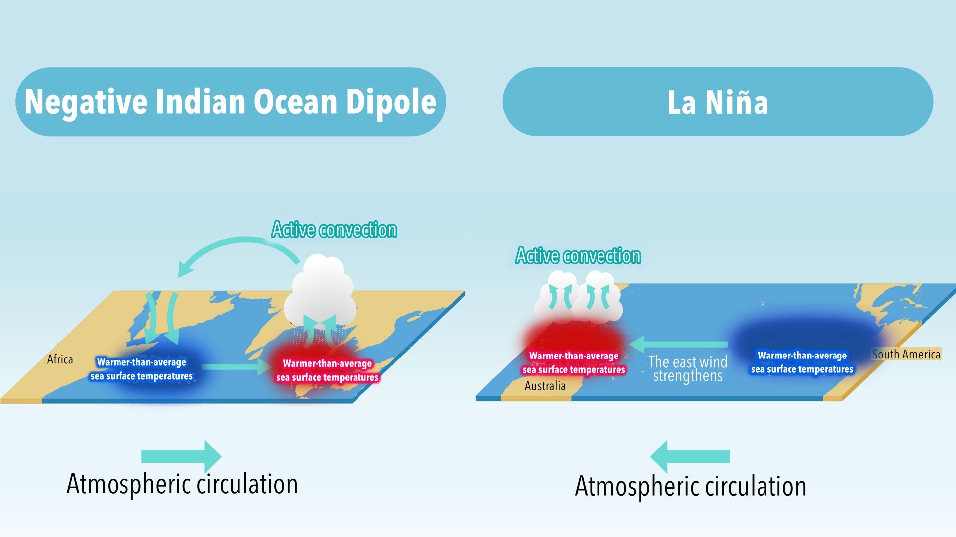
Detailed analysis of conditions at the time revealed that sea surface temperatures and wind patterns immediately before the cyclone's formation differed significantly from normal years. Sea surface temperatures were influenced by a negative Indian Ocean Dipole and a weak La Niña-like sea surface temperature distribution (Figure 2). As a result, sea surface temperatures were higher than normal from the eastern tropical Indian Ocean to the western tropical Pacific, creating conditions conducive to rising air currents across a wide area of Southeast Asia.
At the same time, wind conditions were unusually strong compared to normal years: both the northeast monsoon from the South China Sea to the Bay of Bengal and the westerly winds around the equatorial Indian Ocean were stronger than usual. These winds blowing from opposite directions—east and west—created wind shear (a region where wind direction and speed change rapidly), generating rotational forces
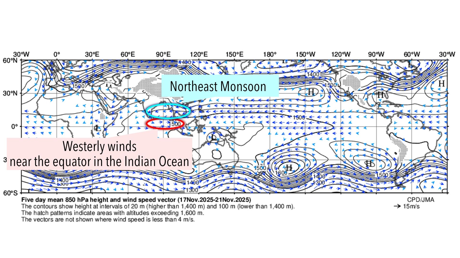
Because the Malacca Strait is located near the equator, the Coriolis effect (the force caused by Earth's rotation) is extremely weak, meaning that rotating cyclones do not normally form there. Nevertheless, a cyclone formed in this strait because two rare conditions for cyclone formation—"two strong winds" and "high sea surface temperatures," both stronger than normal years—coincidentally occurred simultaneously.
Evaluation of Precipitation Forecast Accuracy
For this extreme rainfall event, we compared the forecasts of seven global models developed by various countries. In Sumatra, Indonesia, which suffered severe damage, as of 12:00 UTC on November 23, many models predicted over 100 mm of precipitation for the 48-hour period from 00:00 UTC on November 24 to 00:00 UTC on November 26, indicating the possibility of heavy rain. The model that predicted the highest rainfall was the European Centre for Medium-Range Weather Forecasts' AI weather model, which forecast 239.5 mm; however, this fell short of the actual observed 613 mm.
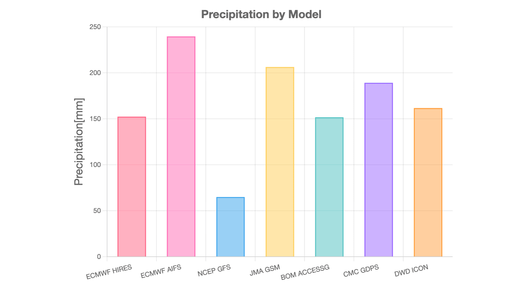
Model Base Time: 12:00 UTC, November 23, 2025 Location: Lhokseumawe
ECMWF: European Centre for Medium-Range Weather Forecasts NCEP: U.S. National Centers for Environmental Prediction JMA: Japan Meteorological Agency BOM: Australian Bureau of Meteorology CMC: Canadian Meteorological Centre DWD: Deutscher Wetterdienst (German Weather Service)
At our company, we employ an ensemble forecasting approach that combines Weathernews' proprietary forecasting models with models from other institutions to deliver highly accurate forecasts. Through ongoing accuracy evaluations, we continuously work to improve our predictions. Moving forward, we will continue rigorous verification of various forecasting models, including AI weather prediction models, to deepen our understanding of each model's characteristics and deliver increasingly accurate weather information to our customers.
Footnotes
Share

March 27, 2026
Ogasawara Islands to Achieve Japan's Highest Weather Observation Density Through Digital Innovation

March 16, 2026
Japan's Most Comprehensive Cherry Blossom Forecast: How Our Proprietary Bloom Prediction Model Leverages User-Generated Photos and High-Precision Data Across 1,400 Locations

March 13, 2026
How TV Stations Are Transforming Weather Coverage A New Content Solution Helping Broadcasters Navigate Weather and Disaster Reporting